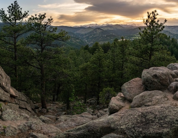
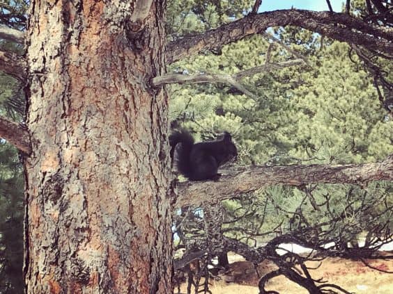
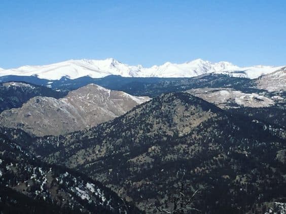
Flagstaff Mountain is Boulder’s 4th highest peak at 7,283 feet and its summit offers incredible views of the Continental Divide, the Boulder range, and the plains. It’s also a fantastic spot for wildlife watching. Deer, wild turkey, raptors, bears, bobcats, and even mountain lions are regularly spotted here. Rocky outcrops provide opportunities for bouldering and the summit area is replete with perfect picnicking posts.
So why is Flagstaff the least popular mountain for hikers to tackle from bottom to top? There are two main reasons: (1) It’s the only peak in Boulder that features a road to the summit. (2) The true summit is an unmarked lump of dirt and rocks. This apparently deters many hikers, but their loss is your gain. Flagstaff’s supposed shortcomings actually make it a very appealing summit hike for those willing to adjust their expectations.
Yes, there’s a road, and you’ll cross it 6 times on your way up. But when you’re on trail, you’ll see very few people until you reach the summit area. And while it’s difficult to escape the occasional sound of cars or chatty bikers, you’ll find beautiful pockets of solitude in between.
To make up for its unmarked summit, Flagstaff’s summit area offers multiple overlooks with vistas rivaling those on Boulder’s more popular peaks. In addition, the Flagstaff Trail provides multiple opportunities to connect with other parts of Boulder’s trail system.
The hike from street level to Flagstaff’s summit is not particularly popular with either locals or tourists, and that’s all the more reason for it to become popular with YOU. Read on for everything you need to know about this rewarding summit hike.
Please refer to OSMP.org for trail conditions and closures as well as dog regulations.
Get there
The Flagstaff Trail leading to the summit begins near Gregory Canyon Trailhead. Head west on Baseline Road past Chautauqua. At the end of Baseline, just where the road bears right and turns into Flagstaff Road, you’ll see a trail sign and the start of the Flagstaff Trail. Turn left to park at Gregory Canyon Trailhead.
Hike it
The round trip hike to Flagstaff’s summit is approximately 3 miles with 1,120 feet of elevation gain – nearly the same mileage and elevation as Mount Sanitas, but slightly less steep and considerably less crowded.
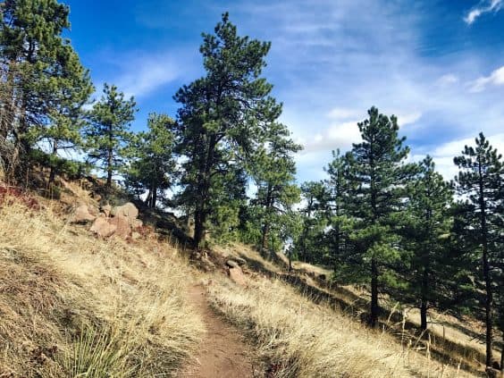
Begin hiking up the Flagstaff Trail from the end of Baseline Road. The trail climbs up moderately with some flat and rolling stretches. About a ½ mile up, you’ll reach signage for the Halfway House and Panorama Point. Stay to the left and continue hiking up toward the summit. Keep your eyes open for wildlife and mind the road crossings. Always look both ways and stay on the crosswalks for maximum visibility.
All of the intersections heading to the summit are easy to navigate except for one. The 4th time you encounter the road at Crown Rock, do not cross over to the Crown Rock Trail and climbing area. Instead, look to your right and you’ll see that the trail makes a hairpin turn. Stay on the trail here and avoid the climbing areas.
At the 6th and final Flagstaff Road crossing, the trail steepens dramatically for one final push to the top. Dig deep for this short but challenging section. You’ll top out at the Summit Road (which is only open to cars during the summer) and then continue on to the junction with the Ute and Rangeview Trails.
Your hike could essentially end here. The true summit is off-trail, just a few steps away in the center of the Ute-Rangeview loop. But you’re going to want some killer summit views and there are none to be found at this exact spot. To get your fix, you have a couple of options. If you’re in a rush to head back down, simply continue north to the interpretive trail. The benches around this trail offer a place to rest plus beautiful panoramas to the north and west. If you have a little more time, take the easygoing 1-mile Ute-Rangeview loop and enjoy the expansive views from the rocky outcrops on Rangeview.
Extra credit
So you’ve hiked Flagstaff from street level to summit. Then you added in some additional meandering to optimize your summit views. Now what? Well, you can easily return the way you came and go celebrate with a beer downtown. Or, if you still have some time and energy, you can go for extra credit. Consult the OSMP map for details and other variations.
Boy Scout & May’s Point: From the junction where Flagstaff Trail meets Ute and Rangeview, head northeast toward the interpretive trail and the Nature Center. Boy Scout Trail will be on your left as you approach the restrooms. The Boy Scout loop with the addition of May’s Point adds about 1.5 miles to your hike and includes a pristine picnic spot with a stellar vista.
Chapman-Tenderfoot Loop: From the junction where Flagstaff Trail meets Ute and Rangeview, take Rangeview to Realization Point. From the Realization Point Trailhead, you can make a beautiful 2.5-mile loop out of Chapman Road and Tenderfoot Trail.
Green Mountain: Why not turn your summit sojourn into a two-peak hike? From the summit of Flagstaff, Green Mountain’s summit (just to the south) is well within reach and you’ve already done some of the work. Take Rangeview to Realization Point. Cross the road and continue through the fire gate to access Ranger Trail. From here, continue up and follow signs to Green Mountain Summit. Boom!
Happy trails, Boulderites!
Photo credit: Alli F. for Your Boulder — all rights reserved