Before September 2013, Saddle Rock was a pretty badass trail. Climbing steeply up to 7,000 feet and highlighting one of the Boulder range’s prominent rock formations, Saddle Rock provided a beautiful and challenging hike. And then came the flood. The trail was severely damaged and didn’t re-open for several months while it underwent repairs. Here’s the good news: this trail is back and better than ever. It now sports a 12-foot metal ladder anchored to rocks on a nearly vertical incline where a section of trail was completely washed out. The Saddle Rock ladder is the only one of its kind in the entire trail system. Suffice it to say, it’s super cool. Whether you’re a Saddle Rock veteran or a newbie, it’s time to take a closer look at this trail’s reincarnation. Get ready to feel the burn while taking in some of Boulder’s most breathtaking vistas.
Be sure to check OSMP.org for temporary closures due to seasonal wildlife activity and trail maintenance.
Getting there: Saddle Rock Trail is easily approached via the Gregory Canyon Trailhead. Gregory Canyon Road is currently closed for flood-related repairs, but the trailhead can be accessed via Baseline Trail in Chautauqua meadow.
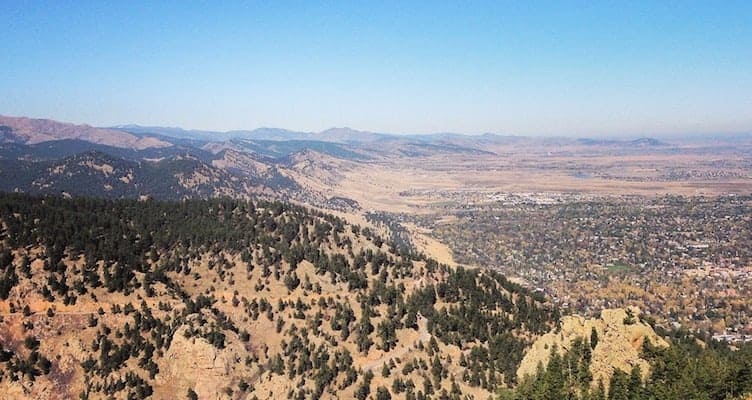
Hiking the Trail: If you like a trail that goes up, up, up, and then goes up some more, then Saddle Rock is definitely the trail for you! Though it clocks in at a mere 1.3 miles each way, it rises nearly 1,500 feet. Be prepared for some steps… a lot of them. And then be prepared for the view when you get to the top (hint: it’s worth it!).
Head toward Gregory Canyon Trail and turn left onto Saddle Rock Trail. You’ll cross the creek and begin a gentle climb through a shaded forest. After a ¼ mile, the trail steepens dramatically and you’ll no longer be using the word “gentle” to describe any part of this hike. To the right, note the extensive damage caused by the flood. The landscape here has been completely changed. The floodwaters carved out a giant gully, and heaps of boulders, shrubs, and trees were deposited in their wake.
As the trail twists and turns, take care to avoid the social trails that veer off here and there. OSMP has placed natural barriers over many of these paths, but it’s easy to get sidetracked if you’re not paying attention.
At 0.5 miles, you’ll reach the junction with Amphitheater Trail. Stay right to continue your ascent up Saddle Rock. Be alert for any wildlife. This area is a magnet for ponderosa-loving birds like nuthatches and woodpeckers. If you pause to listen, you are guaranteed to hear a steady “peck-peck-peck” coming from multiple directions. At 0.7 miles, there is a rocky outcrop to your right. This is not Saddle Rock (though it’s quite impressive), but it is a great spot for photos or a snack.
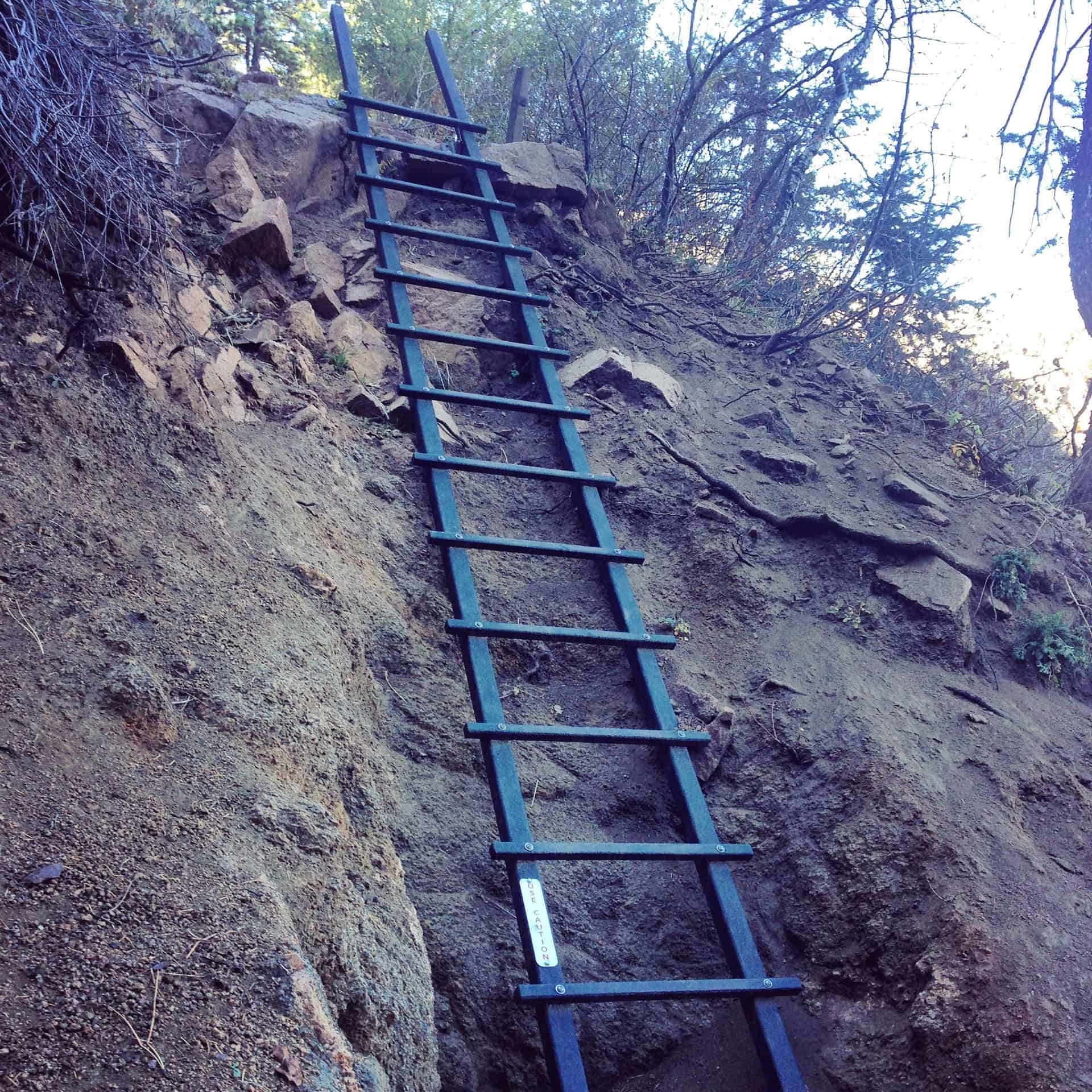 The ladder appears at the 1-mile mark. If you’re able to navigate the trail, you won’t have any problems navigating the ladder. It’s very secure and it’s fun to climb. Past the ladder, the trail continues to rise and a panorama begins to open up to the north. You’ll see the snow-capped Indian Peaks Wilderness in the distance. At 1.3 miles, you’ve reached the top of the trail.
But where is Saddle Rock itself? Good question. Though visible from many vantage points in town, Saddle Rock is not particularly visible from the trail… unless you know where to look. On the north side of the trail’s end is a cluster of boulders. A short scramble through the boulders will take you to a ledge where mountains and plains spread out before you. Look slightly northeast, and there’s Saddle Rock.
To return to the trailhead, go back the way you came or take Amphitheater when you cross it again. Either route is roughly the same distance.
Extra Credit: Consult the OSMP map for various loop options. For a longer hike, connect Saddle Rock to E.M. Greenman to Ranger and return via Gregory Canyon. For a much longer hike, and a little peak bagging, connect Saddle Rock to E.M. Greenman to the summit of Green Mountain. (Note: Please heed the dog regulations on some of these trails.) With so many great options, you can’t go wrong. Happy trails, Boulderites!
Photo Credit: Alli Fronzaglia