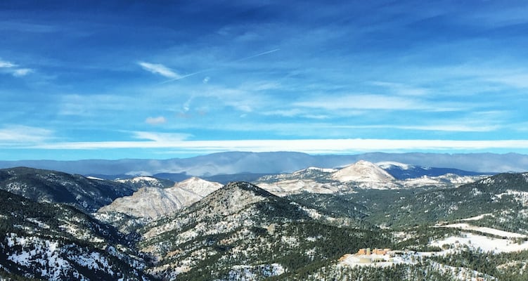
Views, views, views! You want ‘em, and this trail has them in spades. A hike on Boy Scout Trail is the perfect way to soak up some of the best panoramas Boulder has to offer. To top it off, the 2-mile loop is suitable for all fitness levels and accessible any time of the year.
Want more of a challenge? Simply start at one of the lower trailheads for added distance and elevation. The only downside to this trail is that you’ll want to keep hiking it again and again. But that’s not really a downside, is it? Read on for everything you need to know about this Flagstaff Mountain gem.
Get There
From May-October, you may access the trail via the Flagstaff Trailhead on Flagstaff Summit Road. In the wintery months, this road is closed to vehicles. During that time, use the Realization Point Trailhead.
Hike It
As always, consult the OSMP map before heading out. If you’re beginning at the Flagstaff Trailhead, the Boy Scout trail leaves right from there. If you’re beginning at Realization Point, take the Ute Trail and head northeast for 0.6 miles. You’ll skirt past the Flagstaff summit to your left as the trail rises moderately. Continue past the intersection with Range View Trail, and you’ll see the sign for Boy Scout Trail up ahead.
The Boy Scout Trail rolls gently for nearly one mile to a rocky outcrop called May’s Point. This is where the magic happens. Be sure to continue through the boulders till you end at a north-facing cliff. Savor the unobstructed views of Boulder Canyon, Indian Peaks, and beyond. If this view doesn’t take your breath away, nothing will.
Once you’ve finished taking your Instagram photos, turn around and stay left to take the other side of Boy Scout back to where you started. This section of the trail winds through a dense forest, providing glimpses to the east, and finally exits at Flagstaff Summit Road.
If you began at Realization Point, return to the junction with Ute and Range View Trails. From here, take Ute back to the trailhead, or mix it up by taking Range View. Although Boy Scout Trail by itself is about 2 miles round trip, the hike is 3.2 miles total when you factor in the Ute – Range View connector.
Extra Credit
A rolling 2-mile hike isn’t enough for you? Not even if you add in the connection from Realization Point? No biggie. Start at Crown Rock Trailhead to add a little more mileage and elevation. Or start even lower at Panorama Point to add more. Or, what the heck, just start all the way at the bottom and climb the whole mountain, tag the summit, and then do Boy Scout while you’re up there. Variations abound with this fantastic little trail. However you choose to tackle it, have fun and be safe. Happy trails, Boulderites!
Photo credit: © Alli Fronzaglia


