Fall is in the air, Boulderites. The days are getting shorter, the nights are getting cooler, and swaths of autumn color are popping up in town and on the trails. In places like Indian Peaks and Rocky Mountain National Park, the aspen trees have already begun to turn gold. In a matter of weeks, Colorado’s high country will be blanketed in fresh snow once again.
If bagging high peaks is your thing, September is your last chance to grab them while the trails are still dry. It’s also the best time to enjoy them without the big summer crowds. Sure, you’ll need to pack a few more layers and keep an eye on the weather forecast, but experienced locals agree that September is the perfect time for big summits.
A little more than an hour from Boulder, James Peak is a 13er (13,294 feet, to be exact) that’s most easily accessed from the popular St. Mary’s Glacier Trailhead. If you attempt it on a nice Saturday in July, you’ll be fighting your way through throngs of sightseeing tourists, picnickers, and other day hikers. But if you save it for September, you’ll enjoy a much quieter day, gorgeous fall scenery, and one more chance to “get high” before micro-spikes and snowshoes are required.
The timing couldn’t be better and this classic 13er is only a short drive away, so let’s take a field trip to James Peak.
As with all 13ers and 14ers, you’ll need to observe the cardinal rules: (1) Start early to ensure you’re back below tree line by 1:00 pm (before afternoon thunderstorms roll in). (2) Pack the ten hiking essentials. (3) Pay attention to any signs of altitude sickness in you or your hiking partner(s). If you or anyone in your party becomes unwell, descend as quickly as possible.
Get there
The classic route to James Peak begins at St. Mary’s Glacier Trailhead. From I-70, take Exit 238 for Fall River Road/St. Mary’s. Continue on Fall River Road for 8.6 miles, past the town of Alice, and you’ll see two parking lots for St. Mary’s Glacier on the left. These lots are privately owned and there is a $5 fee (exact cash only). The trail to the glacier is in between these two lots (look for the sign that says “Glacier Hike”).
Hike it
The hike to James Peak is 8.3 miles round trip with approximately 2,900 feet of elevation gain. And while James is considered to be an “easy” 13er, it is not an easy hike. Be prepared for a strenuous trek that includes a snow climb and plenty of time above tree line. Allow for at least 6 hours, not including the drive.
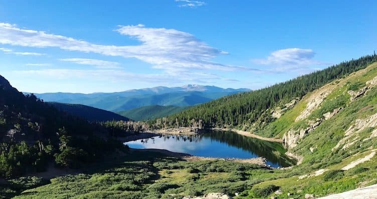
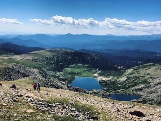
From the “Glacier Hike” sign, follow the trail to St. Mary’s Lake at 0.5 miles. This is a beautiful spot, especially in the morning. The permanent but receding St. Mary’s Glacier looms just beyond the lake and that’s your next stop. Continue past the lake and take either the upper trail or the lower trail to the glacier. Both lead to the same place.
St. Mary’s Glacier is an attraction in and of itself. Many flock to this area solely for the experience of viewing and climbing the glacier. You might spy some off-season skiers and snowboarders getting in a few runs, as well as families playing in the snow. The views are spectacular in all directions.
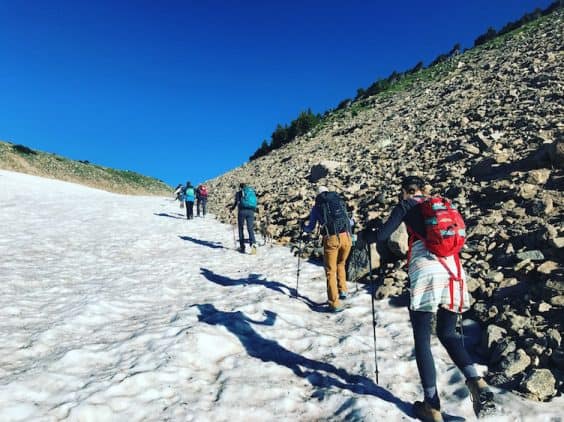
Cautious hikers might want micro-spikes to ascend the half-mile to the top of the glacier. Most hikers do just fine with trekking poles and a little gusto. It’s not a fast or graceful climb up to the top of the snow, but it’s manageable and arguably fun.
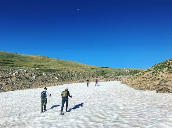
The length of the snowfield varies with weather and season, but you’ll reach the top at approximately 1.3 miles. From this point, look up. James Peak is in front of you, slightly to the right. Mount Bancroft is to the left. Continue on the trail, past a rocky outcrop on your right, and toward the wide Jeep-ATV road.
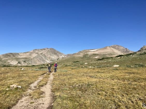
At the Jeep road (the 2-mile mark), the trail becomes “unofficial” and temporarily disappears. Cross the road and continue heading west (staying a bit to the left) as you carefully make your way across a section of open tundra. (If hiking in a group, please scatter as opposed to hiking in a straight line. This lessens the impact on the land.)
Look for cairns and keep your eyes focused on the trail heading up the south slope of James Peak. This will help you stay on track and you’ll soon connect with the narrow but obvious trail about 75 yards away.
Once you’re back on trail, continue toward the base of the peak, past an intersection with the Lake Lomond Trail at 2.8 miles. From here, the trail steepens and views of the Ice Lake cirque open up to your left as you begin the climb toward the summit. Keep the faith as you overcome two false summits and reach the true summit at a little over 4 miles.
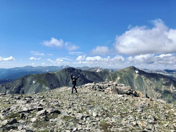
From the summit of James, you’ll have views of Winter Park to the west and James Peak Lake to the east. Enjoy a well-earned break before retracing your steps back to the glacier (glissading down is tons of fun), the lake, and eventually the trailhead.
Happy trails, Boulderites!
Photo credit: Alli Fronzaglia for Your Boulder — all rights reserved