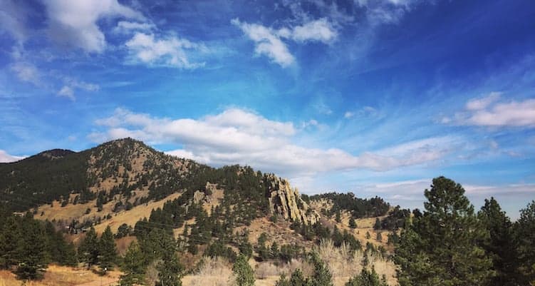
There are few Boulder trails more heavily traveled than the Mount Sanitas Trail. The classic south ridge route to the summit receives hundreds of hikers and runners daily. Locals affectionately refer to it as “nature’s stairmaster.” Most will ascend to the summit (6,863 feet) and then complete the loop by descending via the East Ridge and Valley trails. In fact, Boulderites have been hiking portions of this route for over a hundred years.
The classic Sanitas loop is a staple for many, but it’s so 2015. Since the recent construction of Lion’s Lair Trail and the subsequent connectors to Sunshine Canyon Trail, there’s a brand new summit loop on Sanitas. It’s longer but gentler, and it offers an entirely fresh perspective on Boulder’s favorite neighborhood hill. Read on for everything you need to know about the Sunshine Canyon – Lion’s Lair – Summit Loop.
Get there
This hike begins and ends at Centennial Trailhead. Head west on Mapleton Avenue. Centennial Trailhead is just past the Sanitas Trailhead on the left. There is ample parking, though it does fill up on the weekends. This trailhead features restrooms and picnic tables.
Please note that this hike is NOT suitable for dogs, as they are not permitted on Lion’s Lair Trail. Please read the OSMP dog regulations for more information.
Hike it
From Centennial Trailhead, take Sunshine Canyon Trail as it heads west and gradually increases in elevation. This is a gorgeous, rolling trail that ends in about 1.3 miles at a junction with private property. From here, carefully cross Sunshine Canyon Road and you’ll see a sign marking the spur for Lion’s Lair Trail.
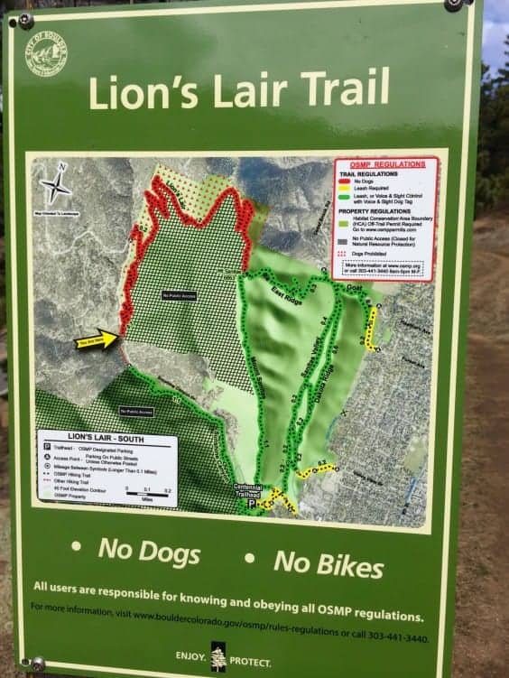
Take Lion’s Lair Spur for 0.7 miles and then stay right to emerge onto the main trail. Lion’s Lair, formerly a neighborhood social trail, was rebuilt in 2015 and is now maintained by OSMP. Its gentle switchbacks are a delight to both hikers and runners. Lion’s Lair is a stark difference from the steep, rocky approach to Sanitas via the south ridge.
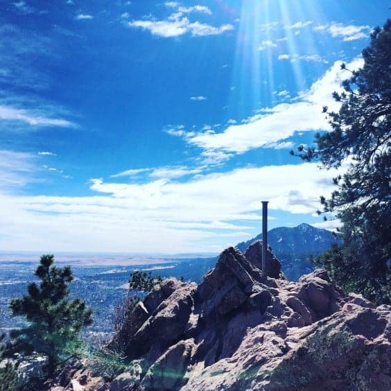
Continue rising through ponderosa pine forest and meadow. Keep your eyes open for wildlife, particularly deer and mountain lion. Two miles from the spur junction and you’ll be at the summit. Savor the views of Boulder and the plains beyond. Don’t forget to turn around and check out glimpses of Indian Peaks through the trees.
From here you can take the south ridge down, but most would agree that the East Ridge Trail is a lot more fun. Cross over the summit to the east, and you’ll find it there. Pay attention as you descend. There are some tricky turns and scrambles. Enjoy the vista as the valley opens up below you.
At 0.6 miles from the summit, you’ll connect with the Sanitas Valley Trail. This well-traveled local favorite is a welcome respite after the tenuous footing of East Ridge. Give your legs a stretch as you take an easy-going stroll for one mile back to the trailhead.
You’ll end at the Sanitas trailhead. Simply cross Mapleton Avenue and head just a bit west to get back to Centennial where you started. Congratulations! You just summited Boulder’s most popular mountain in a brand new way. This loop is 5.6 miles with approximately 1,300 feet of elevation gain.
Extra credit
There are several possible variations and additions to this hike. You might choose to return on Dakota Ridge instead of taking the Valley Trail. The length is about the same but the terrain is slightly more difficult. Or you might like to add the Red Rocks and Anemone trails to the south for more length. Consult the OSMP map for these and other options.
Happy trails, Boulderites!
Photo credit: Alli F. for YourBoulder.com — all rights reserved