Updated September 7, 2026 by Your Boulder.
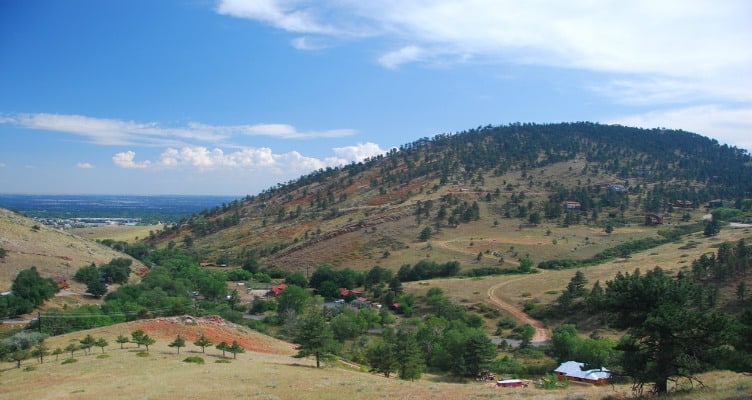
Boulder Heights is a mountain residential area in unincorporated Boulder County, northwest of the city, with homes spread along branching mountain roads. Lee Hill Drive is what most people use to orient themselves. It’s a separate place from the North Boulder city neighborhood, and separate again from Pine Brook Hills, which sits nearby. Shopping and dining errands generally mean heading downhill, toward North Boulder and Broadway.
Streets and geographic anchors
The Boulder Mountain Fire Protection District publishes a streets list that groups neighborhoods for response purposes, and it groups Boulder Heights and Reed Ranch together. Deer Trail Road and Brook Road both appear there. Overlook Lane, Peakview Road, and Lee Hill are part of how the area gets described too. Street names orient you; they aren’t a legal boundary map, so don’t lean on them when you’re pinning down a specific parcel.
BMFPD serves Boulder Heights and Pine Brook Hills, and Fire Station 2 is at 50 Overlook Lane. The district page covers the service area.
Homes were going up here through the 1960s and 1970s. Carnegie Library’s Boulder Heights photo collection documents several of them; its catalog dates the Daniel Rex house on Lee Hill Road to 1964.
Homes and everyday practicalities
For any home you’re considering, check the parcel records and the route to the property. The neighborhood name alone won’t tell you who maintains the road or how the house gets its water.
- Find out whether the road to the house is county maintained or private. The Boulder County Road Map records ownership and maintenance responsibility, so you can look up the road that serves the house.
- Snow removal priorities differ by road class, and county road service is not driveway service. Ask who clears the last stretch from the road to the garage, and what that arrangement costs. The county’s snow removal page explains how the classes work.
- Drive the commute from the specific property, at the hour you’d really be driving it, in the season you’d really be driving it.
- Well and septic systems vary, so verify what’s actually installed at that address and what records exist for it. The county water page links out to private well guidance and SepticSmart.
- Check broadband service at the exact address rather than the general area.
- Get an actual insurance quote for the property. Estimates from anywhere else won’t tell you much.
Anne U. White Trail
For a nearby hike, reach the Anne U. White trailhead on Pinto Drive via Wagonwheel Gap Road. Boulder County rates the pedestrian-only trail moderate and gives its distance as 1.7 miles one way. It follows Four Mile Canyon Creek, with repeated creek crossings along the way. Out and back from the trailhead comes to roughly 3.4 miles.
Dogs have to stay leashed. Bicycles and horses aren’t allowed. It’s day use, with no fires and no camping, and parking is limited to the designated area, with private property right alongside it. Check the county trail page for current conditions and closures before you go.
The county records a long closure after the 2013 flood, with the trail reopening in December 2019.
Use the signed public trail access. A path or road leading toward a neighboring property isn’t necessarily open to hikers.
Schools
Use the BVSD K-12 School Finder with the exact address and the enrollment year you’re asking about. An older neighborhood school list may no longer match the district’s assignments.
The district adjusted attendance area boundaries for some Boulder schools, effective 2026-27. That doesn’t mean every home in the area changed assignment, which is why the address lookup matters.
Wildfire and readiness
BMFPD offers mitigation site visits, and you can request an assessment for your property. Mitigation work reduces risk; it doesn’t remove it.
Know the official evacuation routes before you need them. Download and print the maps, and keep copies in household vehicles, because the route you drive every day may not be the route you’re directed to take during an evacuation. Follow the directions given by emergency personnel at the time.
Sign up for BOCO Alert for emergency notifications, and confirm anything you’re unsure about with the Boulder Office of Disaster Management. The fire district’s community education resources cover power outage planning.
Compare and continue
For the in-town contrast, see the North Boulder neighborhood guide. The full neighborhood overview covers the rest of the area.