
The Plains
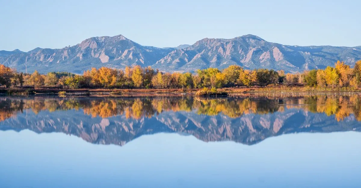
East of the city, the mountains become something you look back at instead of up at, and the sky takes over.
Head east out of Boulder on 63rd Street or the Diagonal Highway and the mountains stop being something you look up at. They become something you look back at: small, blue, and a little unreal along the horizon, while the land ahead flattens into farm fields and open space reaching toward Gunbarrel, Niwot, and Longmont. There are fewer houses out here and a lot more sky.
Boulder Reservoir anchors the area, a roughly 700-acre lake off 51st Street that the city runs as a swim beach and sailing center. The designated swim area typically opens at 10 a.m. and closes at 6 p.m., except Thursdays, when it closes early for weekly Stroke & Stride events. Community Sailing of Colorado teaches lessons right off the beach. A short drive north sits Boulder Municipal Airport, which opened in 1928 and is Colorado's oldest operating public airport, still mostly small planes and flight instruction rather than anything commercial.
Between the reservoir and the towns further out, most of the land stays protected open space or working farmland, crossed by quiet county roads that road cyclists have claimed as their own. The LoBo Trail runs twelve miles of crushed stone from Boulder through Gunbarrel and Niwot up to Longmont, passing close enough to the reservoir that you can sometimes hear the sailboats. Head the other way and the Coal Creek Trail picks up a similarly flat, wide-open ride through Superior, Louisville, Lafayette, and Erie.
Housing is sparse: a scattering of acreages, older farmhouses, and county land, with newer development creeping in from Gunbarrel and Erie at the edges. This part of Boulder is not walkable. You need a car, and bus service thins out fast once you are past Gunbarrel. It suits road cyclists, birders, sailors, and anyone who would rather look at the Flatirons from a distance than live underneath them.
What You'll Find in The Plains
- Boulder Reservoir summers
- Flatiron views from the flats
- Quiet county-road cycling
- LoBo & Coal Creek trails
Living in The Plains
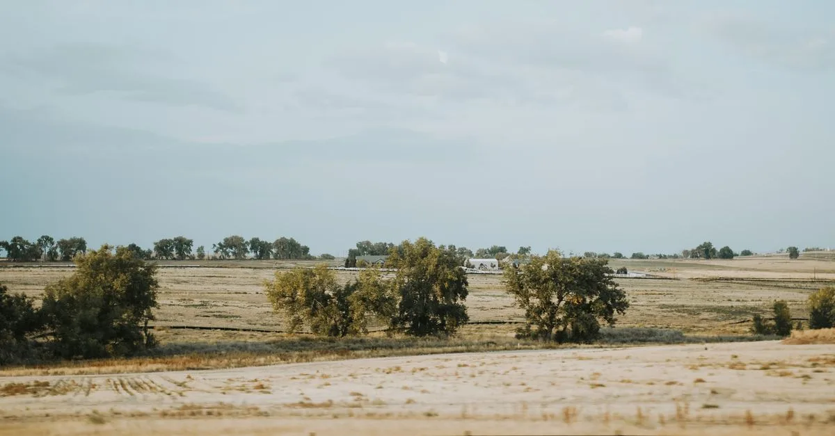
East of Broadway and north of Valmont, the land opens up fast. Fields worked by tenant farmers border two-acre lots with a barn out back, a cluster of solar panels, and a truck parked at an angle that says nobody's coming by uninvited. Most of what's out here sits in the stretch between the Boulder Reservoir and the county line toward Niwot: county roads with no curb, a scatter of ranch houses from the 1970s next to newer builds on well and septic, and enough distance between mailboxes that trick-or-treating means driving between houses. Neighbors tend to be people who wanted acreage more than a walkable downtown: retired ranchers, commuters who work in Denver or at the labs in Boulder proper, and a handful of pilots who keep a plane at the municipal airport a few miles up the road.
Quiet is the main selling point, and it holds up most of the year, except on hot July weekends when the reservoir's parking lot fills by mid-morning and boat trailers line Jay Road. Small planes buzz overhead on practice patterns, more of a background hum than a nuisance once you get used to it. Winter turns the gravel roads to washboard ice, and a stiff wind off the plains can rattle a fence for days at a stretch. The tradeoffs are real: no sidewalks, no corner store, a fifteen-minute drive for groceries, and county plows that reach these roads later than the city ones do. What you get instead is a genuinely dark sky, deer in the yard most mornings, and enough space that the nearest neighbor's dog barking never quite reaches your porch.
Parks & Trails
Boulder Reservoir. A 700-acre city-run lake with a swim beach and sailing and motorized boating by permit, with a straight-on view of the Flatirons across the water.
Coot Lake. A smaller, quieter pond just west of the main reservoir, an easy 1.3-mile loop for a walk or a swim away from the boat traffic.
Sawhill Ponds. Eighteen former gravel-pit ponds off Valmont Road that draw serious birders, including herons, owls, and the occasional bald eagle.
Walden Ponds Wildlife Habitat. Sits about half a mile from Sawhill Ponds and adds more wetland trail and picnic tables to the same birding loop.
Teller Farm Trails. A 6-plus-mile trail system that runs past an active farm with grazing cattle and horses, one of the few Boulder trails that shares space with working agriculture.
LoBo Trail (Longmont to Boulder Regional Trail). A 12-mile regional trail connecting Boulder to Longmont through Gunbarrel and Niwot, the main way to bike out of this area without using the highway.
Where to Eat & Drink
Niwot Tavern. The town's neighborhood bar and grill in Niwot, a straightforward stop for a burger and a beer after a day at the reservoir.
Garden Gate Cafe. Open in Niwot since 2001, the closest sit-down spot for coffee and breakfast before a drive out along the county roads.
Fritz Family Brewers. A family-owned brewery on 79th Street in Niwot with an indoor-outdoor taproom that's genuinely kid- and dog-friendly.
Left Hand Brewing Company. One of Colorado's longer-running breweries, with a taproom on Boston Avenue in Longmont, about fifteen minutes north.
Oskar Blues Brewery Taproom. The Longmont taproom for the brewery that popularized canned craft beer, a short drive up the Diagonal Highway.

Schools
- Heatherwood Elementary. The BVSD elementary school now assigned to the Gunbarrel-adjacent stretch of this area after a 2026-27 boundary redraw; confirm your address with the district, since these lines just moved.
- Centennial Middle School. The BVSD middle school most homes on this side of the area feed into, also touched by the recent Gunbarrel-area boundary changes.
- Boulder High School. The comprehensive BVSD high school serving the Boulder-city side of this corridor, about a twenty-minute drive into town.
- Niwot Elementary. Serves the Niwot side of this area, but it's a St. Vrain Valley school, not BVSD, despite sitting just minutes from Boulder city limits.
- Niwot High School. St. Vrain Valley's International Baccalaureate high school, which also enrolls BVSD-zoned students through open enrollment, a real cross-district option out here.
Hospitals & Urgent Care
- Boulder Community Health, Foothills Hospital. The city's main hospital and ER at 4747 Arapahoe Ave, roughly a 20-minute drive from most of this area.
- AdventHealth Avista (Avista Adventist Hospital). A Level III trauma center in Louisville that's often the closer option for homes on the south end of this corridor.
- Longmont United Hospital. A Level III trauma center in Longmont, the nearest hospital for homes near Niwot and the north end of this area.
Getting Around
Getting anywhere from here means driving, and most county roads feed onto the Diagonal Highway (CO 119), the fastest route into Boulder or up to Longmont. RTD's BOLT bus runs that corridor daily, about every half hour on weekdays, with a stop in Niwot, though the Niwot Park-n-Ride is closed for CO 119 Bus Rapid Transit construction and won't reopen with its expanded lot until 2027. Closer to Gunbarrel, Route 205 connects the Jay Road and reservoir turnoff to downtown Boulder, but it's a bus you plan a trip around, not one you catch on a whim. Cyclists get a better deal: the LoBo Trail runs mostly flat between Boulder and Longmont through Niwot and Gunbarrel. At the reservoir itself, plan on a paid day-use pass and a real parking lot rather than roadside parking.
Frequently asked questions about The Plains
Is The Plains walkable?
No. This is car country: Boulder Reservoir, the airport, and the nearest grocery stores sit miles apart, and RTD bus service thins out fast once you are past Gunbarrel. Road cyclists make good use of the quiet county roads and the LoBo Trail, but you will not be walking to errands out here.
What can you do at Boulder Reservoir?
It is Boulder's summer hub: a roughly 700-acre lake with a swim beach that is typically open 10 a.m. to 6 p.m. (closing at 5:30 p.m. on Thursdays for the weekly Stroke & Stride events). Community Sailing of Colorado runs lessons right off the beach, and the reservoir also draws boaters, anglers, and picnickers all season.
What trails start near here?
The LoBo Trail is the main one, twelve miles of crushed stone running from Boulder through Gunbarrel and Niwot to Longmont, passing close to the reservoir along the way. Head southeast instead and the Coal Creek Trail links Superior, Louisville, Lafayette, and Erie on a similarly flat, gravel path.
What is housing like in The Plains?
Housing out here is sparse and mostly rural: acreages, older farmhouses, and county parcels rather than subdivisions. Newer development is creeping in from Gunbarrel and Erie at the edges, but the core of the area stays protected open space and agricultural land.
Is this area good for families?
It works well for a family day out. The reservoir beach and flat trails like the LoBo Trail are easy going with kids. But there are few schools, parks, or everyday amenities out here, so most families end up living in Gunbarrel or Niwot and visiting rather than living right on the plains.
More Local Guides
Photos: EG Images / Pexels · Lalada . / Pexels · Mike Kutz / Pexels
Never miss a thing in Boulder.
Boulder's best events, concerts, happy hour deals, comedy shows and editorial picks. Delivered to your inbox every Friday at 7am MT.