Editorial update: September 7, 2026 by Your Boulder. Original author: Tara Calihman.
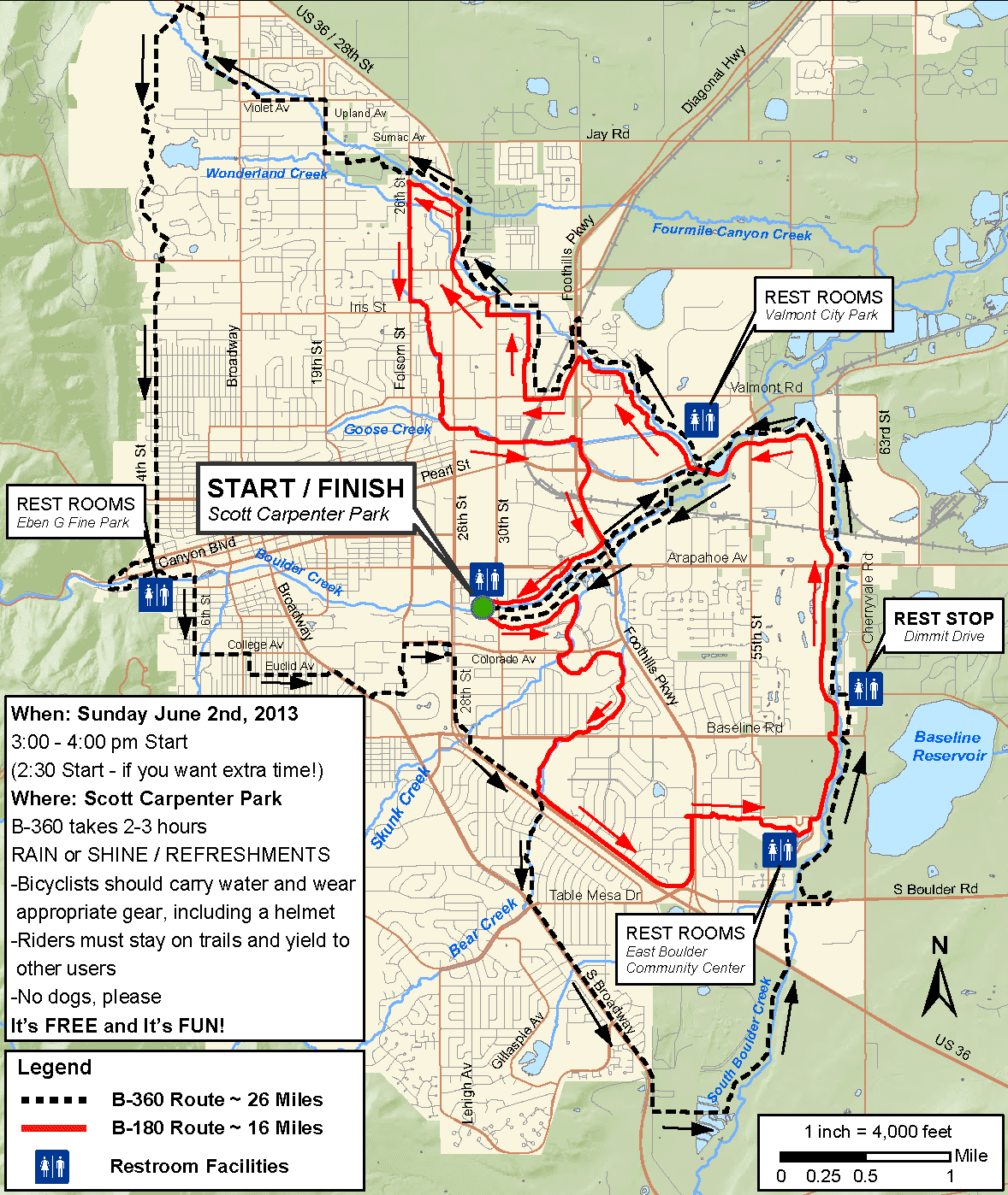
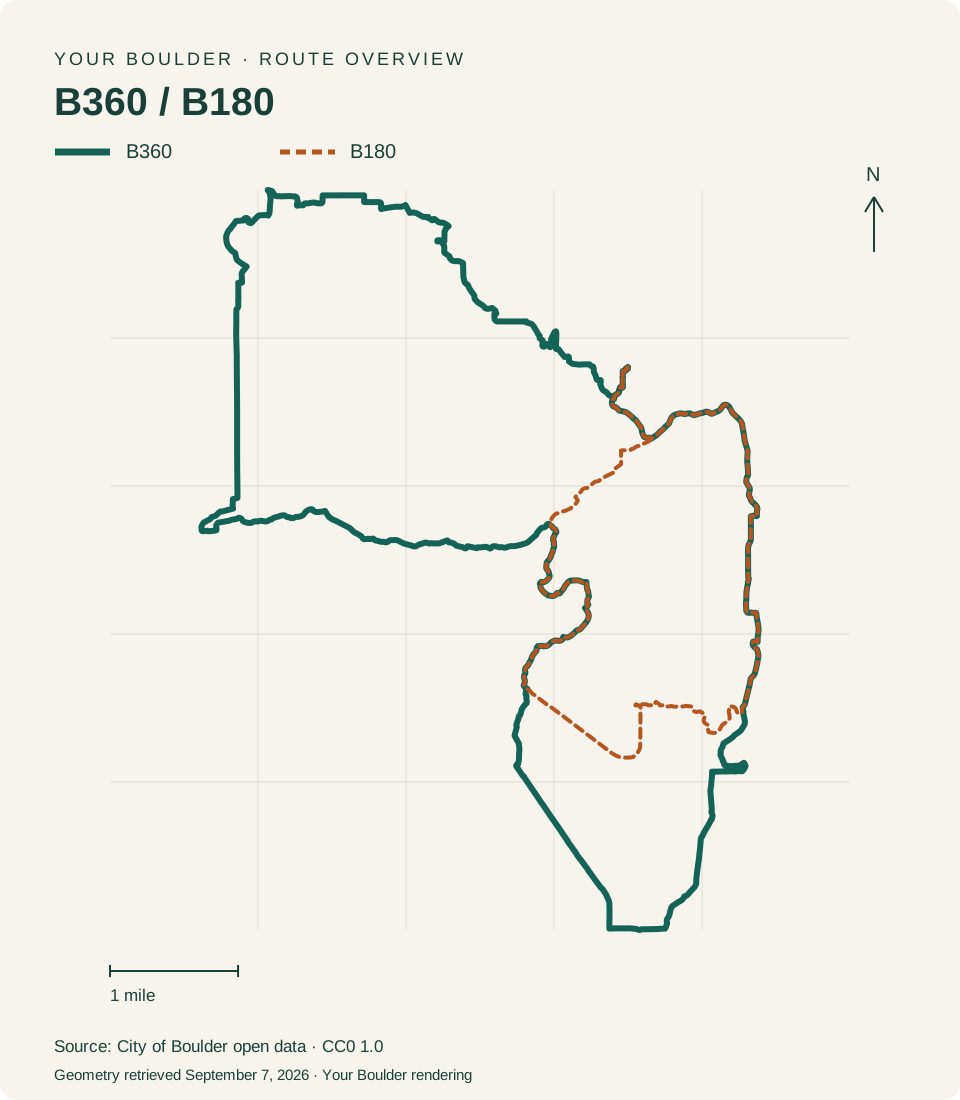
The B360 and the B180 are two signed rides that the City of Boulder publishes on its bike services page. The city lists the B360 loop at 24 miles, and it circles the city. The B180 is listed as a 12-mile route. Both are rides you plan and do on your own schedule, using the city's map, so the first decision is which distance fits the day you've got.
Choosing between 24 miles and 12 miles
Compare the published mileage against what you've ridden recently rather than what you rode a few summers ago. Twenty-four miles is a different commitment from twelve once you add stops, headwind, and the ride out to whatever point you start from. If you're riding with kids or coming back after a layoff, the 12-mile B180 is the shorter option, and you can always ride it again. Neither number includes your approach to the route or the trip home, so add that in.
Ride from the official map
The city's interactive map has a Recreational Bike Routes view with separate layers for the B360 and the B180, so you can turn on just the route you're riding. The geometry in those layers is supplied by the City of Boulder. You can also switch the map over to show the complete bike network and destinations, which helps when you want to link the ride to somewhere you're going anyway.
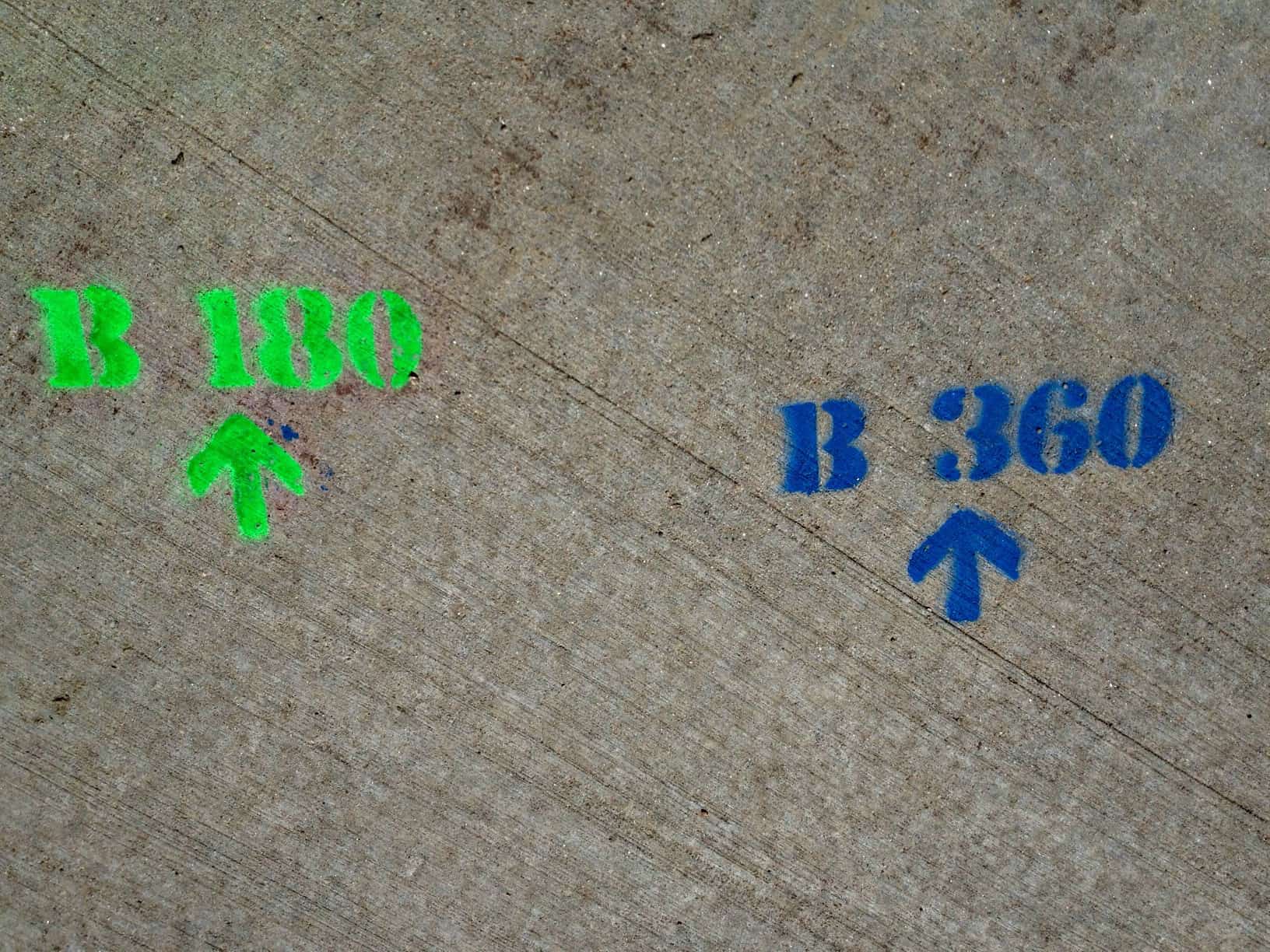
The city's bike map covers lanes, routes, and multi-use paths, plus destinations and connections between them. In a June 2025 city notice about strolls and rolls, the city described refreshed markings on the paths; those painted markings complement the official route map rather than replace it. Don't count on a fresh painted arrow at every turn. Keep the map open.
Rules where the route is shared
Much of the network is shared with people on foot. Give pedestrians priority, keep right, and pass on the left. Announce yourself before you pass. On streets, ride with traffic. The city identifies dismount zones on sidewalks in the University Hill commercial area and on and around the Pearl Street Mall, so plan to walk your bike through those, and obey posted dismount signs wherever you see them. If you're riding between sunset and sunrise, city code (BRC 7-5-11) requires a mounted white light on the front of the bike and a red reflector at the rear, per the city's bike and scooter light safety page. A red rear blinking light is recommended there rather than required, and it's worth adding.
Self-guided ride, not a scheduled event
This page used to carry a 2013 event notice with its own mileage figures and event-day details. That notice has expired and none of it applies now. What remains is the route itself, which you ride on your own schedule and with your own repair kit. If an organized ride is held, check that event's organizer for its start time and for whatever on-course arrangements it does or doesn't provide. We're not announcing a date for a 2026 ride here.
Before you head out
- Pick your start and return point on the map first, since where you join sets how the mileage falls across your day.
- Save or screenshot the map section you need. Phone service and phone battery both fail on long days.
- Check for construction and read posted signs as you go. Signs on the ground govern, whatever the map shows.
- Water, a spare tube, a pump, and tire levers. A flat tire miles from your car is a long walk in cycling shoes.
- Lights if there's any chance of finishing in the dark.
How we checked this
We reviewed the city's bike services page, the official Recreational Bike Routes map layers, the June 2025 city notice on path markings, and the city's travel rules on September 7, 2026. We didn't ride or survey either route and we're not measuring distances ourselves. The city's open data terms release public datasets under CC0 1.0 with no warranty of completeness or accuracy, so confirm against the official map before you ride.