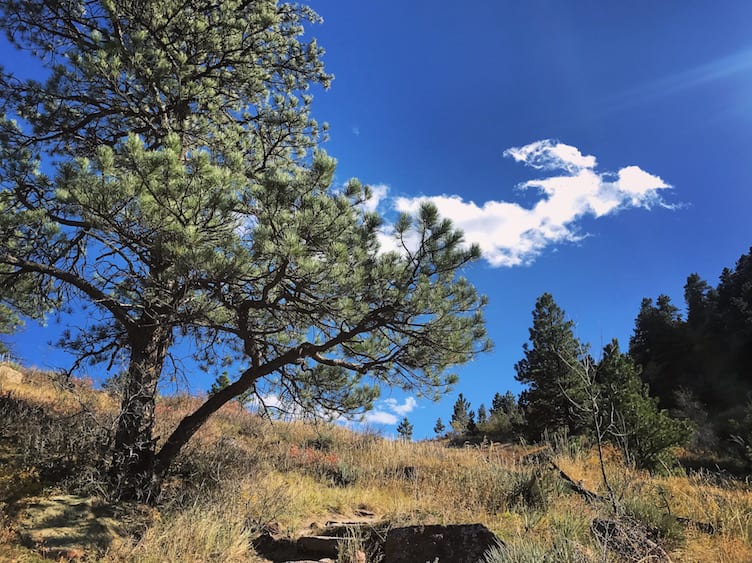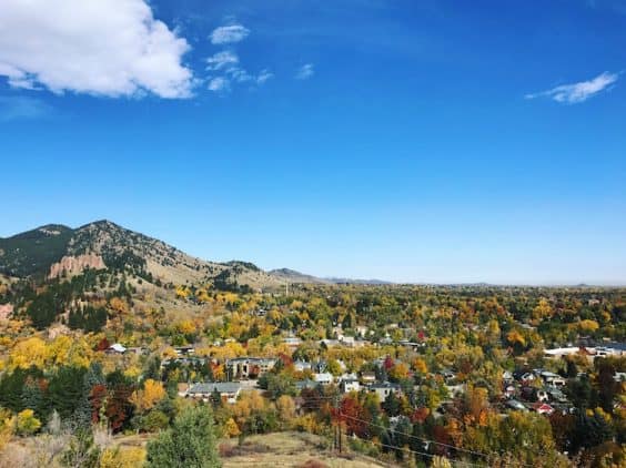
Boulder is home to more than 35 trailheads and 150 miles of trails. Even with millions of open space visitors per year, there’s no reason for anyone to battle crowds or get stuck doing the same old hike. Trailheads like Sanitas and Chautauqua are extremely popular with both locals and tourists, but experienced hikers know better. Neighborhood trails are where they’re headed – away from the crowds and closer to what makes Boulder’s open space so special.
What’s a neighborhood trail? It’s a trail that isn’t widely known beyond its immediate location. It’s tucked away from the busiest parts of the trail system and used predominantly by those who live within close proximity. Its name does not ring a bell for most. Even those who’ve hiked it may not know what it’s called or how to find it again. And in an ever-popular hiking destination like Boulder, neighborhood trails are where peace, quiet, connection to nature, and personal discovery may still be found.
Viewpoint Trail is the ultimate neighborhood trail on the ultimate neighborhood hill. Winding its way up the northern flank of Flagstaff Mountain, Viewpoint receives only a handful of hikers daily, but (as the name suggests) it provides some of the best views in Boulder. It can be hiked as a moderate out-and-back or it can be connected with Flagstaff Trail for a longer, more challenging hike. Read on for your guide to this neighborhood gem.
As always, please consult Boulder’s Open Space and Mountain Parks for trail conditions and temporary closures. Dogs are permitted on Viewpoint Trail. They must remain on leash unless they have a Voice and Sight tag.
Get there
The primary access point for Viewpoint Trail is across the street from the entrance to Eben G. Fine Park. Take Arapahoe Avenue west and continue past 4th Street. A dirt road will be on your left, across from the entrance to Eben G. Fine. Park on the street and hike up the dirt road to the fire gate. There’s a sign for Viewpoint Trail just beyond the fire gate. An additional access point can be found where University Avenue dead ends at Marshall Street.
Hike it
The aptly named Viewpoint Trail (0.9 miles, 800 feet of elevation gain) offers beautiful views of the city, Mount Sanitas, and Boulder’s Red Rocks. It also tops out at Panorama Point, a scenic overlook with interpretive signs about Boulder’s past, present, and future. And while Panorama Point is a popular spot for tourists to visit by car, visitors rarely make it onto the actual trail that leads to it.
From the main access point, begin hiking up the hillside to the right of the trailhead sign. The trail switchbacks up at a moderate pitch, eventually moving over to the east side of the mountain. As you ascend, the views get better and better.
Keep your eyes open for wildlife. Fewer human visitors means more privacy for local critters, and this area is home to many of them. Depending on the time of day and the season, you might see deer, bobcat, raccoon, skunk, bears, or even mountain lions. Birdwatchers will enjoy hummingbirds, spotted towhees, and turkey vultures in the summer, along with year-round residents like chickadees and flickers.
Once you’ve crossed the drainage pipe, you’re about ¾ of the way to the top. Continue along to the picnic bench and Panorama Point overlook just beyond. From here, enjoy sweeping views from Chautauqua meadow to Hogback Ridge. The city and the plains stretch out to the east. A mix of sun and shade, along with some strategically placed benches, make this the perfect spot for a snack or picnic lunch.
Extra credit
Once at Panorama Point, you can return as you came or continue hiking. Cross Flagstaff Road to connect with Flagstaff Trail. From this trail, you can head up to the summit of Flagstaff Mountain or descend the mountain’s southern slope into Gregory Canyon. Visit OSMP’s interactive map for details and other variations.


